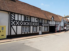
Map of Aston Clinton
Map of Aston Clinton Buckinghamshire, a village to the east of Aylesbury.
Aston Clinton Map Buckinghamshire England
Aston Clinton Map Bucks: Find streets, roads and amenities in the Buckinghamshire village of Aston Clinton, using this handy interactive map. Clearly shown is Aston Clinton Park, the Baptist Church and St Michael & All Angels Church.
Aston Clinton has around 3,680 inhabitants and is located just 4 miles from the centre of Aylesbury. The postcode for Aston Clinton is HP22.
More Buckinghamshire Maps:
- Road Map Stoke Mandeville Bucks
- Road Map Aylesbury Bucks
- Road Map Weston Turville Bucks
- Road Map Wendover Bucks
- Road Map Halton Bucks
TOP - Aston Clinton Map - Aston Clinton Plumbers
Find Local Tradesmen: Painters - Electricians - Carpenters - Builders - Gardeners - Roofers - Tilers - Locksmiths - Metalworkers - Bricklayers - Cleaners - Plumbers
BUCKINGHAMSHIRE MAPS - HOME PAGE


