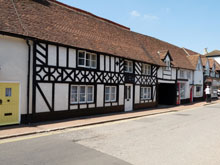
Map of Soulbury
Map of Soulbury Buckinghamshire, a village to the north-east of Stewkley and Cublington.
Soulbury Map Buckinghamshire England
Soulbury Map Bucks: Find streets, roads and amenities in the Buckinghamshire village of Soulbury, using this handy interactive map.
Also visible on this Soulbury map are Hollingdon, Black Spinney, the Grand Union Canal and the A4146.
Use navigation buttons on this Soulbury street map to get a closer view, or move around to see other areas surrounding Soulbury in Buckinghamshire.
More Buckinghamshire Maps:
- Road Map Slapton Bucks
- Road Map Stoke Goldington Bucks
- Road Map Thornborough Bucks
- Road Map Stowe Bucks
- Road Map Stoke Hammond Bucks
TOP - Soulbury Map - Soulbury Plumbers
Find Local Tradesmen: Painters - Electricians - Carpenters - Builders - Gardeners - Roofers - Tilers - Locksmiths - Metalworkers - Bricklayers - Cleaners - Plumbers
BUCKINGHAMSHIRE MAPS - HOME PAGE


