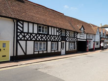
Map of Great Kimble Buckinghamshire
Map of Great Kimble Buckinghamshire, a village to the north-east of Princes Risborough.
View Larger Map |
Great Kimble Map Buckinghamshire England
Great Kimble Map Bucks: Find streets, roads and amenities in the Buckinghamshire village of Great Kimble, using this handy interactive map.
A tiny village in the county of Buckinghamshire, Great Kimble (combined with Little Kimble) has a population of 960. The postcode for Great Kimble is HP17. Great Kimble is located on the A4010 between Monks Risborough and Stoke Mandeville.
Also visible on this Great Kimble map are Monks Risborough, All Saints Church, Church Lane, Bridge Street, Little Kimble railway station, Little Kimble Hill, the A4010.
More Buckinghamshire Maps:
- Road Map Lacey Green Bucks
- Road Map Bierton Bucks
- Road Map Aston Abbotts Bucks
- Road Map Cublington Bucks
- Road Map Aylesbury Bucks
TOP - Great Kimble Map - Great Kimble Plumbers
Find Local Tradesmen: Painters - Electricians - Carpenters - Builders - Gardeners - Roofers - Tilers - Locksmiths - Metalworkers - Bricklayers - Cleaners - Plumbers
BUCKINGHAMSHIRE MAPS - HOME PAGE


